

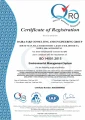
ISO 14001:2015 — Daira Sabz Afghanistan (305025060492E)
Environmental Management System, independently audited and annually renewed
We combine digital transformation, environmental intelligence and spatial technologies to help organisations improve efficiency, strengthen monitoring and convert complex information into actionable insight.
Daira Sabz develops secure, scalable and user-centred solutions for engineering, environmental, mining, infrastructure, heritage and development-sector organisations. Our capabilities range from digital strategy, cloud infrastructure and custom software to environmental monitoring, laboratory analysis, GIS, remote sensing and digital heritage documentation.
Environmental Management System, independently audited and annually renewed
Quality Management System, applied across all project phases and deliverables
Authorised to conduct EIA/ESIA under Afghanistan's national environmental framework
IHK Stuttgart Member No. 2811134, eligible for EU contracting and cross-border delivery
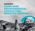
Recognised for innovative clean air solutions and environmental excellence
We help organisations modernise operations, integrate systems, automate processes and use data more effectively through secure and scalable digital solutions.
Connected laboratory workflows, automated data capture, and compliance-ready reporting for environmental and materials testing programmes.
Integrating tradition and technology through GIS, remote sensing, and participatory documentation of cultural heritage landscapes.
Four reasons clients choose us for this practice area.
Solutions are designed around genuine engineering, environmental, institutional and field-level requirements.
Sensors, laboratory results, GIS, cloud platforms and management dashboards can be connected within one workflow.
Systems are structured around user needs, organisational readiness, accessibility and long-term adoption.
Modern digital techniques are applied without disregarding local knowledge, cultural context or community stewardship.
We develop web and mobile applications, dashboards, databases, APIs, enterprise platforms, cloud solutions and sector-specific monitoring systems.
Yes. We design APIs and data pipelines to connect legacy systems, field tools, laboratory outputs, and management dashboards.
Yes. We implement sensor networks, telemetry, and real-time dashboards for environmental, infrastructure, and operational monitoring.
Landscape archaeology uses GIS, remote sensing, and field survey to document cultural heritage landscapes, integrating traditional knowledge with modern spatial technology.
Yes. Smart Lab connects laboratory workflows, chain-of-custody tracking, and automated reporting for environmental and materials testing programmes.
Yes. We provide mapping, spatial analysis, satellite imagery interpretation, and drone-based survey for engineering and environmental applications.
ESIA, IEE, monitoring & evaluation, biodiversity and natural-resource studies that meet international standards.
Geotechnical investigation, resource assessment and responsible, compliant extraction strategy.
Civil engineering, infrastructure and road projects engineered for durability and safety.
End-to-end programme management and capacity development that keeps complex projects on time, on budget and accountable.
Work with our digital, laboratory and spatial-technology specialists to define a practical and scalable solution.